But in reverse. And not complete. You can find descriptions of the route in various places, for example here. Arguably, after Wednesday going down to Fionnay I was off route; but I don't care. Here's my route, overlaid on the "official" map from Kev's book, the 1991 edition I think. Yellow dots for start / sleep / end.

Sunday August 21st: Zermatt to Zinal
GPS: Jungen to Gruben over Augstbord pass; Gruben to Zinal. 32 km; 8 hours; +2000 m.
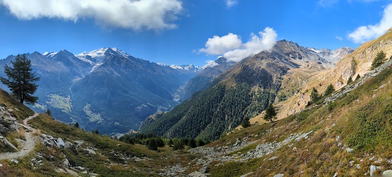
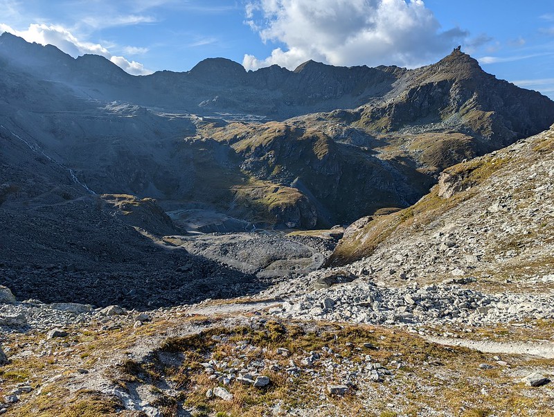
Jungen has a baby cable car (12 CHF) so I use that to save myself 700 m of ascent. It is only four persons so wait for second lift, after the slight embarrassment of being tactfully told I wouldn't fit into the first one. Up! At top, resto, a few houses, and a sign for Augstbord pass: push on; it is charming and green and has great views but I'm late in the day. 11:45 2405 rest. Mostly sun, some relief by cloud, some grateful shade from trees. Views! Across to Gratchen up valley to Tasch I think. If you're worried about getting lost, the Swiss are in the habit of signing their paths.

Above: view from just above Jungen; views R back up the Mattertal not showing Zermatt. Below: pano from above the tree line.
Top 2890 13:15 a grind, whew. And so 10 mins rest - there's a chill wind at the col - and then a bit more than 1000 m to descend down to Gruben.

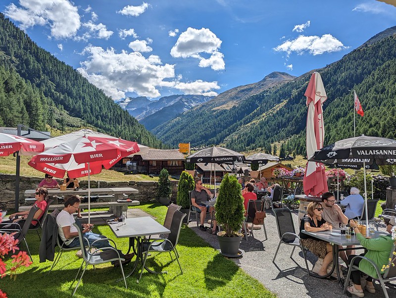
Fine views across to the next ridge. The path turns out to be fair and goes painlessly (looking back to col); down to hotel Schwartzhorn at 15:25. Cafe. Sitting under shade in a comfy chair with a second cafe and the excuse that my watch is still charging looking out at green grass then woods then ridge and distant snow (possibly les Diablons) is v pleasant. If I was single-staging, I'd be stopping here.
But I'm not, so at 4:10 off, pausing briefly to look inside the church with its fine stained glass. Along road over bridge grass up valley then head up. Long even gradient road and bonus: its in the shade. Up. 6:55: to top of Forcletta, which is quite decent. I am lighter by one ski stick which fell off somewhere, alas. Book (booking.com) hotel Besso in Zinal, since I'm now likely to make my time, and head down, only 1200 m to go. Briefly see fox in the undergrowth.

Looking down towards Zinal:
How long will the light last? Sun behind peaks at 8 but still fine and the route is good - indeed, it is the route of the Sierre to Z run and I keep passing signs saying "6 km to go"... and so on. But it is a long traverse. At last do last descent 8:45 as light fades but lights of Zinal come on so no need for head torch. Besso is right there… but reception is shut. Ask in Poste who says ask in Europa who phones guy and (with mutual apologies) by 9:10 I'm in my room and shower. Whew: a long day.
Monday 22nd: Zinal to la Gouille
GPS: Zinal to la Forclaz to les Hauderes; les H to la Gouille; 20 km; 6 h; +1500 m.
B'fast 7:30. Feeling a bit battered from y'day but we'll see. Wx: sun above little cloud still shade here. We're now in French speaking Swiss so I feel less like an idiot.
Besso: fine. Decent old building and room (e.g. Fr window-closing). B'fast good. Also Poste and Europa looked ok. Zinal is a smallish pleasant village probably optimised for skiing. Shops, supermarkt, etc.
9: get lift up 800 m to Sorebois 7 CHF (with half-price from hotel): we're back to vaguely sane lift prices. Today should be more relaxing: start with cafe at topstation 24xx. Thin cloud hugs mountain. And, I can speak to people.
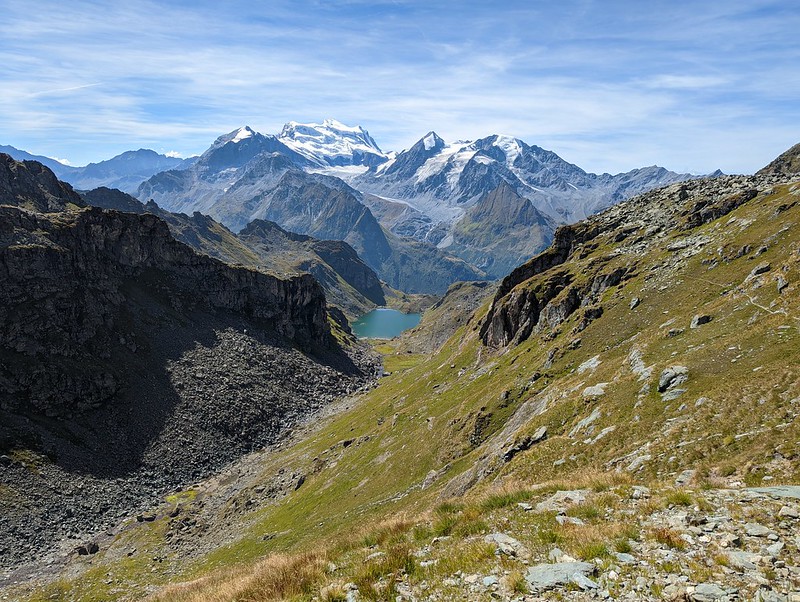
Col (2850, under Corne de Sorebois, not 2812): 10:50. Sun. Views down to v blue Barrage de Moiry. Bread (pain Paillasse, still fresh) and cheese and half hour rest. Z side is a bit of a ski-scape.
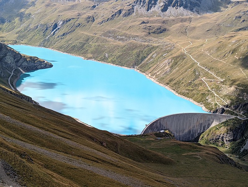
Descent easy passing many poor folk labouring up. 12:10: lac/barrage de Moiry 2250. Lovely blue, views to sunlit grassy slopes and lowish peaks beyond, cafe. There's a bus service and camper-van overnighting at the far end; and a gite; and a via ferrata.

Hour for cafe+coca. Around lake, bread+houmous at far end. Path up obscure from here. Off 14:20.
15:25 rest at 2640; the path resolved itself at the bridge as it should. Clouding; hints of spots of rain; but clearing as I climb. Distant cowbells.
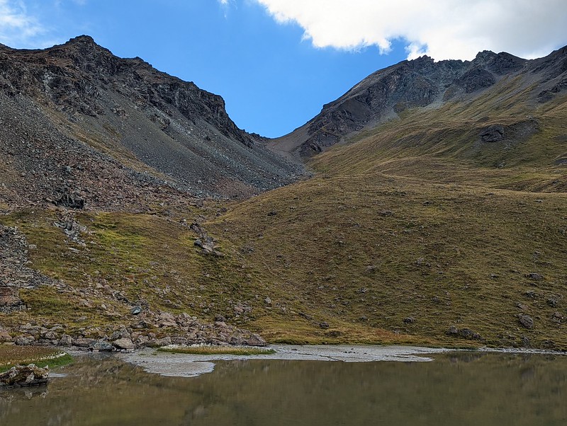
Col Tsate, 15:55. Ahead: sunshine; scree; then a plateau with lake. Pt 2975 aka Cherra is reachable to the S but no.

La Forclaz 17:45 disappoints (despite the beehives lower down): the only cafe is on hols and accom is thin and expensive (the village itself is cute). But! Find dorm another three miles on, so its marching time again. 18:25: les Hauderes, cafe+rest+watch recharge. I have discovered SAC app will show gps location. 19:45: la Gouille, little place, cute, bed in dortoir but that's fine I'm the only one. To bar for - gasp - an actual bierre, pression, Valaisienne. Route here from lesH was the "old road" I'm pretty sure, now just a track.
Tuesday 23rd: La Gouille to Cabane Prafleuri via Pas de Chevres and Col des Roux
GPS: La Gouille to Arolla to col Pas de Chevres to lac des Dix (8h; 1100 m); Lac des Dix to col des Roux to Cab Prafleuri (1:30; 400 m).
B'fast 7:30 pay 40 inc bierre and off 8:50; it is v quiet and deep valley NS so sun is way above so all very dewy and early-feeling. Decide on road to Arolla. There is the old track but it is so quiet the road is fine. The sun rises over the valley edge.

Arolla initially disappoints: the grand hotel Mont Collon is shut and there's little else but! Upper or center Arolla is much better: cafe, epicerie, shop. Although I don't know it at the time, this turns out to be pretty well my last "village" of the walk. 9:50. Rest over cafe for half hour and admire Mont Collon opposite outlined against the relentless blue sky.
Up 100 m to another Grand Hotel and they have a lovely green law with parasols but alas no service and then they start mowing the lawn so I move on.
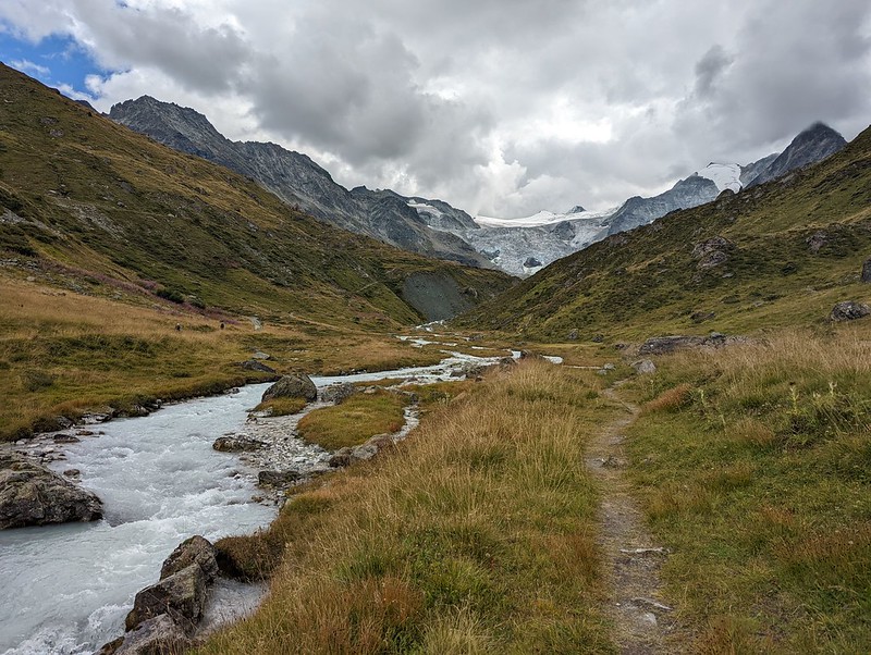
Pas de Chevres 2850 13:00. Whew. A pull under the sun (heading up). Views over to Lac des Dix and glacier / Lac de Cheilon. Also ref des Dix perched up an eminence opposite. Snooze. Bees. Possible distant Matterhorn. Pano:
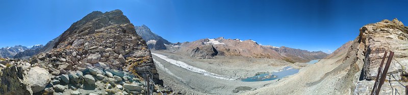
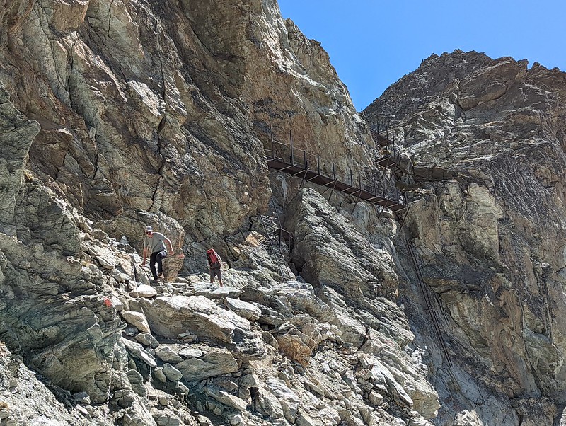
Ladders (easy: broad, not vertical, platforms, short. Now I look, you can see the old steeper ladder hanging off unused to the right under the platform; and in the foreground, the chains section) then chains. Easy if you've done any via ferrata, but the grockles were making something of a meal of it.
Then get overconfident: I end up taking what might be an old path, with paint splodges, then decide I don't trust it and leave it and… end up scrambling down scree, right down to the "bank" of the glacier above the lake. Sigh, again.
I do have enough margin to be safe this close to the ice but errrm well. Then to level area former glacier lovely walking and little lake… should I?
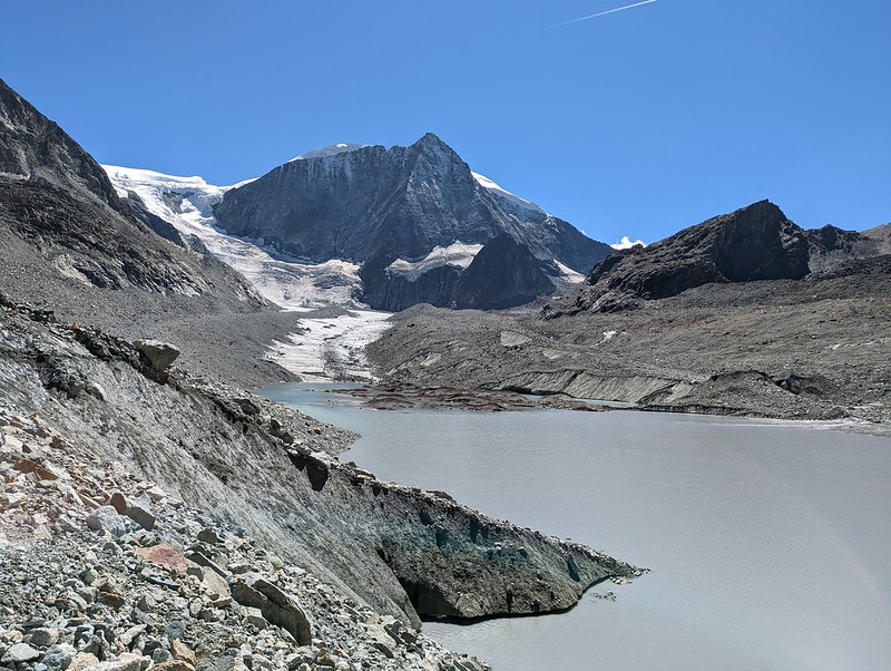
(pic: looking S to Mont Blanc de Cheilon (3870), the triangle on the R; Glacier de C., center; L (probably) Pointes de TsenaRefien. View from further down.)

Yes! Swim. Cool, refreshing. All is quiet bar distant river/w'fall. Find replacement Arkenstone of Panda. Realise I can lace boots so toes are loose: helps little toes be less squashed. Pic: looking W to La Luette (3547) I think. You wouldn't believe how much of a pain setting up this selfie was.

16:00: 10 mins rest+snack at the top of milky blue-white-grey le lac des Dix. Which is vast. Scenery above was grand.

And so round. View back. Quite a long way but stays lovely. Stop to re-power gps and play with stream. At last, to turn up to Col des Roux. (On the way, La Barma, which I think would have had a refuge if I'd wanted one... des Gentianes? La cabane est gardée uniquement durant les weekends. Pendant la semaine, le bâtiment principal (cuisine et dortoir 15 places) ainsi que les toilettes restent ouverts à tous perhaps). It is only another 400 m how hard can that be? Bouquetin.
Top, 18:30. Whew.
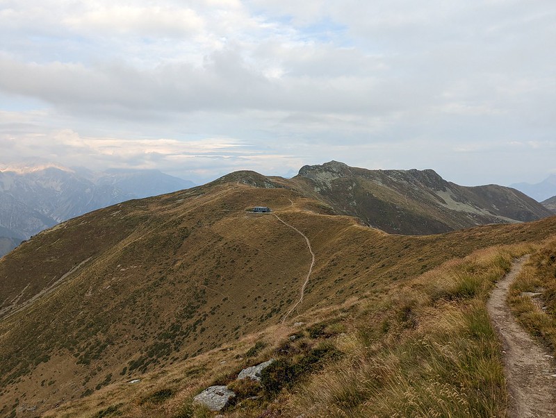
Can just about see my hut, Cabana Prafleuri (it is slightly tucked in to the R by the umbrellas, not the "obvious" building in the center). Only 200 m down and decent path so arrive mid-dinner.
Off boots etc put phone+watch on power then register, in broken Fr and their better Eng. And then sit outside with a ViviKola, the Swiss cola since 1938. Pic: the hut. To the L, the new buildings. The wooden stuff to the R appears unused. They have good taste in wildlife posters. I finally abandon ol' Plato to the Boite a Don. Inside: salle a manger.
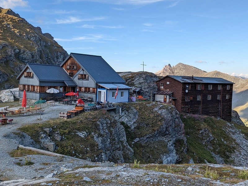
Oddities: a locker for your rucksac; and they provide a disposable sheet-liner and don't want you to use your own. 40 chf. No signal.
For dinner I have bread from Zermatt, not yet finished; the remains of the houmous; and some cheese. It is surprising how little I've felt the need to eat; I had one Farmer bar today. I don't see any showers; toilets appear few. Bed, 20:45. I'm done with Bacon: prosy, prolix.
Wednesday 24th: to Mauvoisin
Cabane Prafleuri to Louvie across le Grand Desert (9k; 5:30h; +500 m; but there are GPS gaps); Cabane de Louvie to Fionnay (4k; 1hr; -800 m).
Note: I was only vaguely following the "true" route if there is one; going down to Fionnay isn't the offical path, instead one heads off towards Verbier; but that looked dull and rather low to me. So after today, I'm definitely off-route.
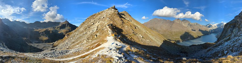
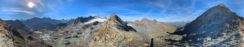
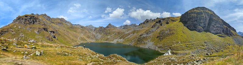
Various snoring o'night but sleep well. Up for 7, one of the last, what are these people doing? They are all walkers. B'fast a bit confused cos I don't have a proper place: 4 slices bread butter honey and coffee. Off 8 heading for Col de Prafleuri (signpost): 9: 2987 (signpost; the small lake is the Lac de Cleuson but we're not going that way). Note: col is a little to R of where you might expect. On the way: battlin' bouquetins on the hillside up before the col; view and pathmarkers up towards the col. Looking back. At the top there's a large pathmakers crowbar. Just visible: the refuge. Pano at the col: to the left, the past; to the right, the future. In the middle, beyond the line of the ridge, is the rather nice Rosablanche with the Glacier de Prafleuri to the L (closer) and rather more hidden barely-a-glacier-any-more Grand Desert.
Across le Grand Desert to Col de Louvie, 2921, 11. Rest. This was the view to start:

So it kinda lives up to the name. Inevitably, there is stuff about the retreat of the glaciers; more. Signpost to Col de Louvie, or down to Cleuson. Ahead lies Lac Louvie, and beyond Le Grand Combin; more of tha anon. Flowers! On the way down... on this side of the lake still high up, there's an old stone cabin converted into a rustic shelter / refuge.
By the lake there's a long stone barn (you can see inside) with a panneau about how they made it: heaped up earth, built the arch over it, then dug the earth out.
1:30 to Cabane de Louvie. Coke, poire tarte. The first food I haven't carried myself since… Zermatt I think. Oh, excluding b'fast obvs. Signal, just, if you sit overlooking the valley. Enjoy views especially over to Grand Combin. Pano: the lake.
Off 3. Down. Towards Fionnay and the Val de Bagnes. 4: down to Fionnay which tantalises with hotel (shut, and notice about souris) and cafe (fermi le mercredi). But there's a bus (7.60) up to Mauvoisin in an hour so sit back (literally in deckchair outside quiet tourist office) and let their wifi suck up my pix. There's also a glorious w'fall 300 m when not blown away by wind.
5:30: at Mauvoisin which has hotel-cafe & that's all and get a space in dortoir. Sit on terrace awaiting my bierre… which is good. Dinner: could be part of package but go for pates bolognaise instead. And it is v good.

After, pay (73 total) and to dortoir to rest. Snooze. Wake 8 realise I could look around… won't pass dam tomorrow perhaps tonight? It is 190 m up… in fact it is vast, mostly hidden by trees here. Lots of interesting history. Three brass figures donated by the architect of the dam. View down: the waterfall a golden line. Tiny chapel. Path up, after a bit… disappears into rock. Still open, unsupervised? Go in. And in. And up. Posters; info on the dam. Pix of construction. Spoooky esp when I think they might shut doors. Up, a long way. Come out 10 m below dam top, and there's another tunnel, road this time, to the top. Its getting late but clearly there is much more one could explore. And so, down.
Thursday 25th: Mauvoisin to Cabane Panossiere; to Cabane de Mille
GPS: Mauvoisin to Cabane Panossiere (8k; 3hr; +1000 m); Cabane Panossiere to Cabane de Mille (15k; 4hr; +700 m)
B'fast 7 v quiet; brief convesation in Fr with german-speaker off 8. Cool still in deep valley sun higher.
View down to Mauvoisin with the dam (view down from higher up):

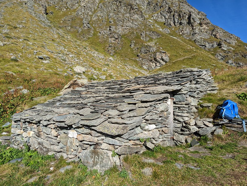
1 h up: sit by La Tseumette old low stone with maintained wooden sleeping platform. Since this is only 1 hr in, I could have kipped here last night, had I known. For the future!
10:40: to Col des Otanes (signpost) fairly easily (some of the aid is just a bit silly; the steps and the chains aren't really needed). View up towards the col; and with le Grand Combin just peeking out.
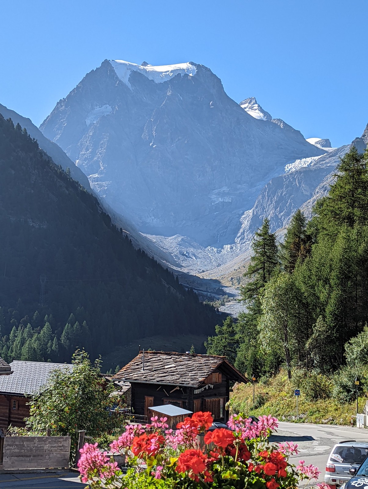
Descend just a little to gasp in awe at my new favourite mountain, le Grand Combin. Pano. At this point I'm off the official "haute" route but I think it is worth it.

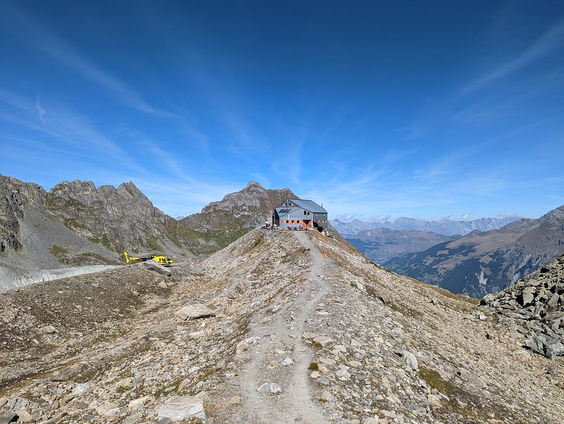
Doesn't look too easy though. Below and to R Cabane Panossiere with bonus yellow chopper.
Looks like they are having to jump through hoops to get water in these times. Rest relax at hut (signpost). C'est sympa. Eau is potable. There are showers including one al fresco. Like most, there is free charging. M texts: when is my flight home? Oh you know what maybe I didn't book it… oops. Book: £225 plus £50 hold bag. I'd be outraged but as a percentage of the holiday it isn't much; and is a useful lesson. When I arrive the staff are having their dinner but that's OK; sit out with a little bread and cheese. Hut history one and two and three. Hut book pages; and more.

Off 1:45 for Brunet. Yet more edelwiess, though admittedly a bit scruffy. There are two ways: low and high; and I realise I can take the low. Down moraine... swiftly the glacier turns into mank, and hence...

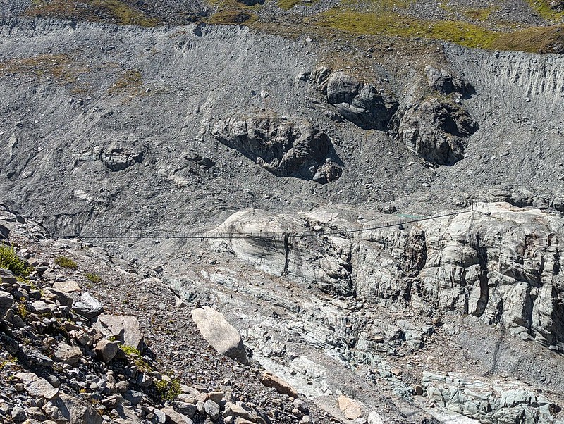
...there's a loong suspension bridge over...
...and turn down, though col up looks green and inviting. Pass pathmakers with rakes and pickaxes. Note: generally I don't describe scenery: there are pix for that. Here we are looking back; ahead is getting greener. There's another suspension bridge, but smaller.

4:10: Brunet. Smallish. Bierre and tarte aux prunes; water is scarce. Liddes looks like tonights target? But which way? Another little old stone shed converted into a bothy. Pause, 6ish, to wash in stream all over: this I discovered from y'day's pool: it makes the rest fresh, as long as I don't steam along in the hot sun. View round, towards the little stream in it's meadow.
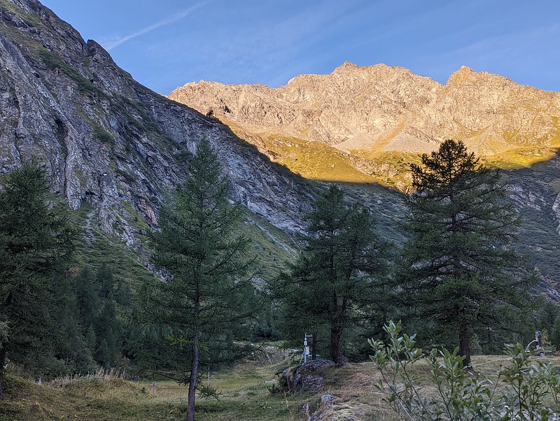
7: the route is such that over the col makes sense: 150 m left. But I don't think I'll make Liddes: it is finally time to sleep out. I feel a bit afraid: how will I cope? But also a bit sad: this is so reminiscent of the old TMB days with M, and now I am alone. Distantly: cowbells. Across the valley: Verbier. Ahead: the last of the light in the grass.
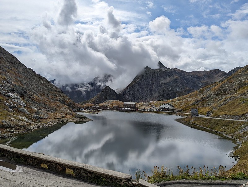
To col. And, as the map said, there is a cabane. But not the empty thing I expected. It is a refuge: Cabane de Mille. Weeell: ok. Why not? Nicely placed nearly on ridgeline, just as sun disappears into cloud. Dinner - which I didn't want - is over but a place is CHF 25, fine. Plus b'fast plus coca plus p'card of Gr Combin. And so the sun quietly sets and light fades. They have a map of a possible circular walk (ah: the Tour des Combins); but not much water (but they do give some out). Outside late: there is weak network on valley edge.

Friday 26th: Cabane de Mille down to Bourg St Pierre; up to Grand St Bernard; to Ferret
GPS: Cabane de Mille down to Bourg St Pierre (13k; 3h; +300 m); Bourg St Pierre up to Grand St Bernard (13k; 3h; +1000 m); Grand St Bernard to Ferret (11k; 3hr; +375 m)
Sleep slightly hotly… I think I got careless with my blankets. Up 7 off :30. Sign says 3:45 to Bourg St Pierre: can that really be so? Yes; well, 3 h. Mostly traverse across vast hillsides to the sound of cowbells, but with ups into little valleys. Today is cloudy, which is welcome, except it is blocking my view of Mt Blanc. Here's the hut, perched on it's spur (more distant; ahead). Tiny private hut/shed by the side of the path.
BSP disappoints: the village is cute but all life is on the road; cafe. What next? Gr St Bernard seems obvious and I think I'll go for it. But I need to rest to let my phone and watch charge.

This Hotel du Cret is perfectly typically Fr: old woman and bloke running it; croissants at the bar; fiddly decoration and sports trophies and the like. And quiet :-)
Start up (signpost). Looking grey ahead and then… rain. For about two hours. Now eased off, and am having brief rest in little shelter 2270 ish. It even has a fireplace, and the bench has an inspiring motto. View out of the window.

Also, I need a new raincoat; I've been spoilt by lack of rain up till now. Put mitts on: hands cold. But keep on up and end at col (before: some olde stone-paved sections). Note: the walking path is a bit annoying as unlike the road it is distinctly non-monotonic. There's the grand monastic buildings avec resto and musee de chien but go for little cafe...
...which looks far more like my kind of place. Sit, recover, recharge phone+watch and outside a little sun emerges. Here we are looking over the col.
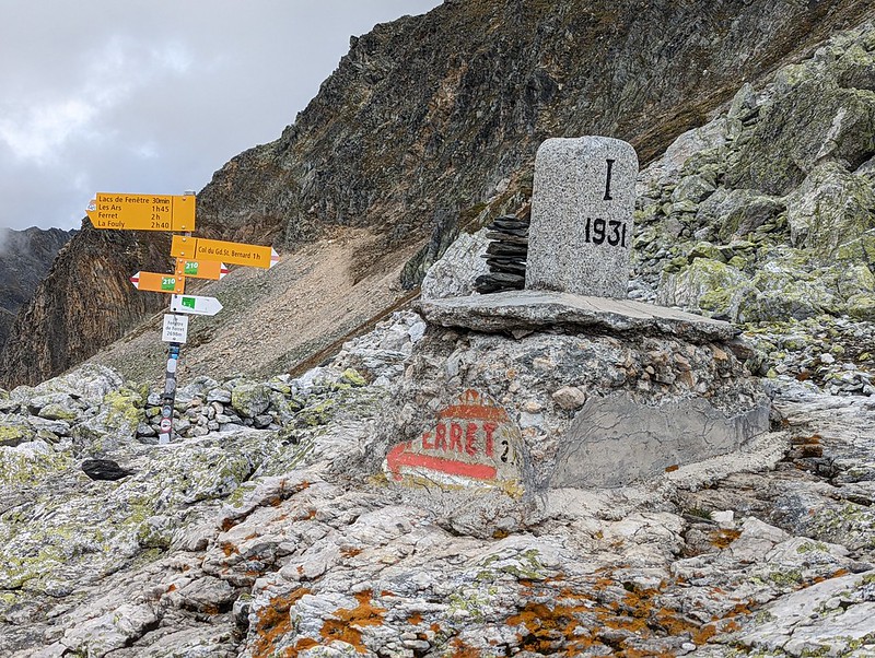
And now for the final act… Col de Ferret. Up we go (with dodgy start; you have to go down and round; don't get confused by all the routes) on the 13A...

...and top, and we're back in Swiss. Me!
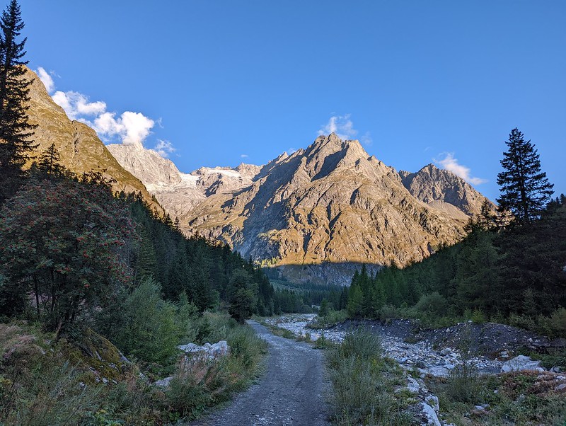
And in cloud too. Well, head down. It is quite dramatic, wild lonely and steep. Finally desc out of cloud, keep on.

After a bit things become more civilised and I'm finally descending to lower altitude.

I was originally heading for La Fouly but Ferret (sign; plus me) does not disappoint and has hotel so stop there around 7. I get a bed in the dortoir (another view), but am the only one. Shower. Wash socks. Look around a little, in particular the local chapel (interior; image; another).

To bar for biere, catch up phone, and bed. Eat very last of cheese. Note: I still have some Farmer bars left.
Saturday 27th: Ferret to La Fouly; bus to Orcieres; train to Sembrancher then Martigny then Chillon; boat to Lausanne
GPS: Ferret down to La Fouly (3k; 40 mins). At this point I could have, if I'd felt like it, continued on towards Chamonix, possibly getting that far. But I've been there before, and going down to Martigny from here is "natural", and I felt like spending some time on Lac Leman.
To La Fouly (sign). Back to gorgeous wx.
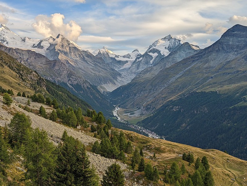
TMB runners lean and stringy; folks en route cheer+cowbell. View back: farewell, mountains!

Happily in time to get 8:48 bus Orcieres. Then 9:20 train to Sembrancher; and connection down to Martigny. Then a little gap and 10:16 to Chillon via Aigle, buying yog+juice+melon in interval. And brief stroll near station: good.
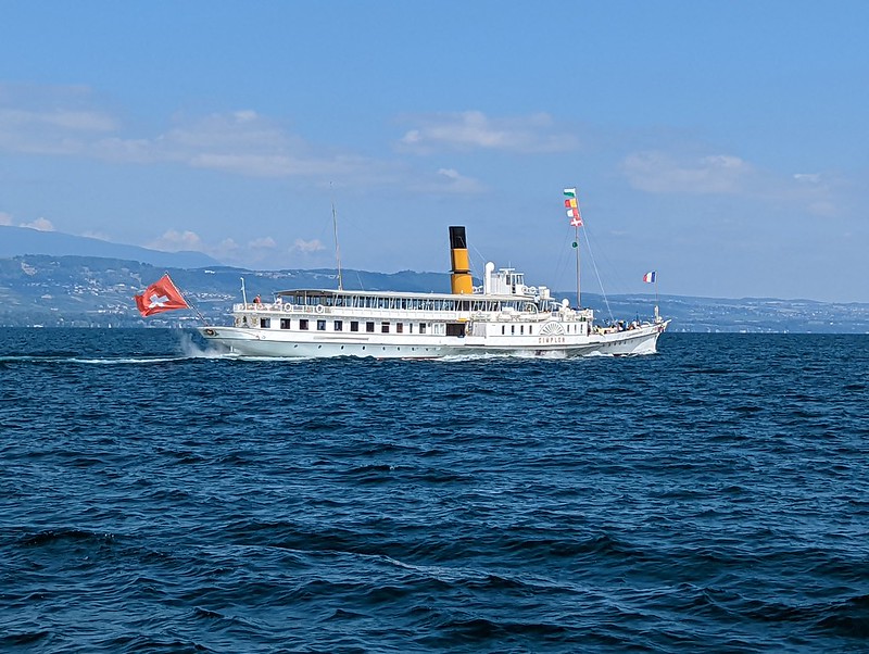
That concludes the walk in the mountains. I leave you with Chillon, where I swam