Saturday: Carneddau
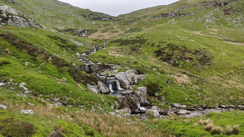
Having driven from Oxford - I have various excuses for not taking the train - I stayed overnight at the "Grand" hotel in Llandudno (by the Great Orme! Gogarth! I've never been to Gogarth) and after some regrettable car-park comedy1 dropped my plan to walk out of Conwy on the coastal path in favour of starting from Abergwyngregyn (more conveniently known as "Aber falls"), which has a very convenient off-main-road parking spot. There's a broad path up to the Aber falls, and a scree path up the side of said falls, and then it gets more open and rather nice. See GPS trace, which also has more pix, as of course does Flickr. Elevation gain on the day, 1670 m, total distance 28 km.
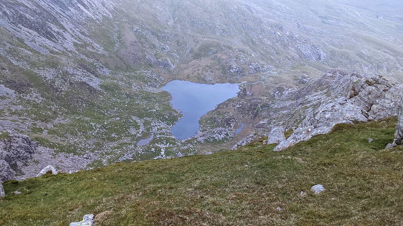
However, I'd decided to do Drum; although only 770 m (3000 feet = 914 m) it was kinda there, and I wasn't in a hurry, so I took a rather eccentric contouring path above Llyn Anafon. In retrospect, taking the earlier valley of Afon Anafon would have made more sense. But! I wasn't there to make sense.
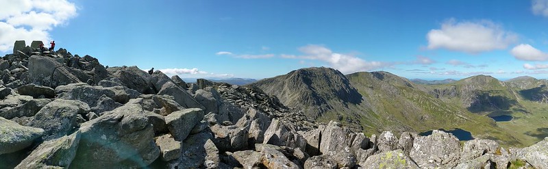
Somewhere around here my trail shoes - which were a decade old and inherited from Maz - started to fall apart; I tied them up with cord. Happily it was just the sole separating from the "basket", which latter proved quite robust. Here's the Llyn, and a pano from Drum.

Incidentally I had no physical map with me at all; I was relying on Google maps, and OS snippets from the 3k website (Carneddau section); this worked, though Google maps are pretty blank up there. At this point it is all very soft and gentle; here's Foel Fras, 942, the first.

The summit is rocky and there's an exciting trig pillar. And so things proceed; see GPS trace. In poor viz, it could easily be a nightmare.
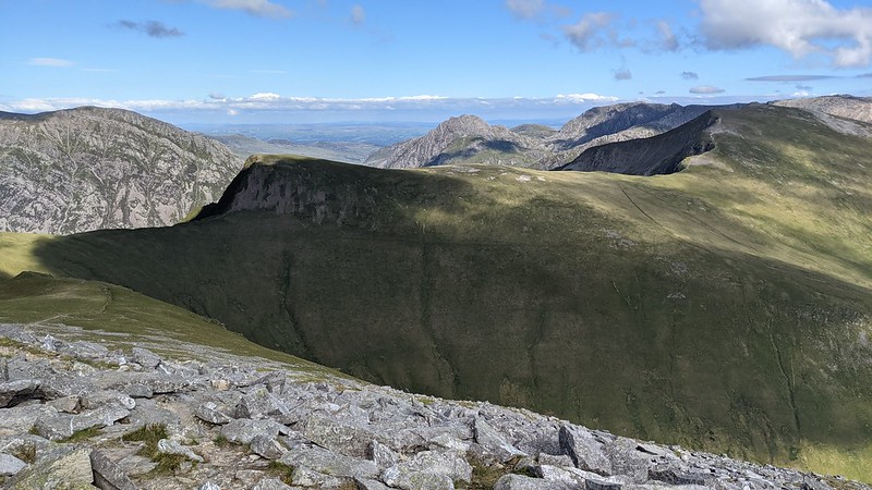
Continuing from Foel Grach (GPS trace) which has an emergency shelter (pix: ext; int). Yr Elen is off on a spur of about 1 k's (easy) ridge; here's a pano of it looking back to Carnedd Llewelyn and down to lake Ffynnon Caseg. Note kewl cloud.

It was getting on for... around 8 pm at this point, but the day was lovely and the light holding well. I stopped for my evening porridge at a low wind-break-shelter under Carnedd Dafydd, looking over Afon Llafar towads Bethesda.
Pushing on I got over the rather dull bulk of Pen Yr Ole Wen (although it was about 10 pm there was a large party on top) and starting descending to my intended bivvi spot on the outflow of Ffynnon Lloer beside which - you can just see if you know where to look - someone had camped.
It was getting quite dark when I got down, so here's my bivvi spot taken the next morning. I had with me a rubbish old thin closed-cell carrymat, and an exciting expensive new Thermarest Uberlite, which I even inflated. Then I thought (a) this turf is so lovely I don't need the Uberlite; and (b) this turf is interspersed with pokey heather that might puncture my Uberlite. So I did without it.
Sunday: Glyders
Last night had been moderately windy, but this morning was still, and I was forced up by the midges. Not zillions of them, but enough to keep me moving. So, descent (GPS) to the road, just at the head of Llyn Ogwen. I tried (see GPS) to head straight up, but it isn't really possible, so ended up pathing around, then up, following some other folk; but from about 600 m up I was on the nose.

Tryfan - and indeed the Glyders generally - seemed to me somewhat less friendly than the Carneddau, more inclined to have summits awkwardly covered in giant boulders. From Tryfan I progress over Glyder Fach and Fawr (GPS) and down to Llyn y Cwn (see-also last October). From near the top of Tryfan:
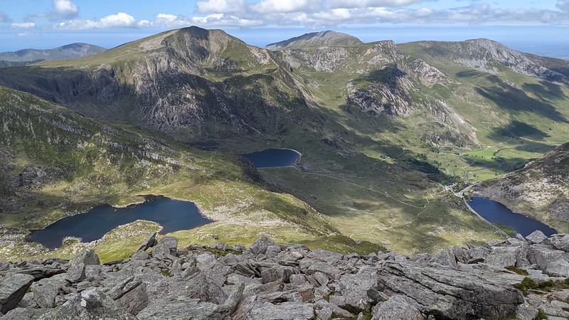
Llyn Ogwen in the valley, R; Idwal centre; Boclwyd, L. G Fawr beyond, I think. From the summit:
Adam and Eve far L (no, I didn't), Fach centre (you go up the paler scree-y stuff L of the more solid ridge R). And so on down to the lake. It was sunny, I was hot and sweaty, and so went for a swim, although brief, for it is not warm. I failed to take an afternoon pix; here's an evening one, with me camped out:

It was a beautiful evening. But! I haven't finished the hot afternoon yet. I contemplated my future, specifically how to deal with Elidir Fawr; I didn't like the "std" descent from that to the road, nor did I want to camp by the road. So I resolved to leave my pack (sadly I didn't think of that till past Y Garn), do E Fawr and return to the lake (GPS). In terms of ascent or distance, this doesn't really make sense, because the "std" path gets you down to the road only a km away from where I ended up descending, and the road is nearly level at that point. Hey ho; it did get me a nice campsite. What it also got me (because I foolishly didn't replenish my water bottle in the stream) was very thirsty.
This is from E Fawr looking back to F Goch and a more distant Y Garn (947 m). It's all rather nice. Back at the lake I made my evening porridge and dozed. Late on, it grew a bit windy, so I put on the bivvy bag.
Monday: Llanberis
Monday woke me with a brief small shower at about 5 am, so I pulled all my spare gear into my rucksac and dozed again. At around 7 rain set in and continued. I was happy to discover that my three decade old bivvi bag is still waterproof. How to get out of it and into "walking mode" was going to be a bit tricky since I hadn't of course set up the tarp last night. So I did it spasmodically in the morning and it just about worked, with my head as one "pole". I then set off to descend, which is a real path, honest, just not a very well marked one (GPS). Eventually I found and followed the fenceposts down.
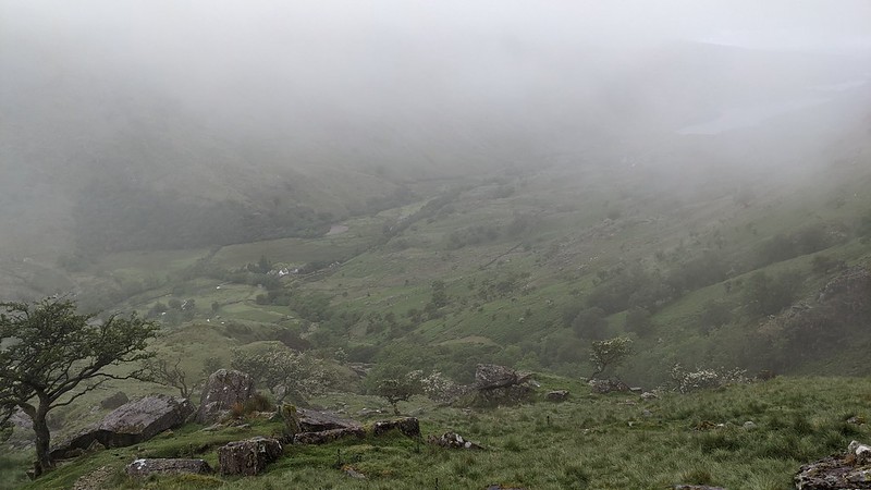
About half way down I did come out of the cloud, here we see rather more typical Welsh scenery. The plan now called for me to walk up the Llanberis pass to the Youth hostel, but alas my left knee was unhappy, and the peaks were completely enveloped in cloud. I decided on sanity and walked down to Llanberis, which is quite a long way (GPS). Better pic to Llanberis; and view of the path up from the road. And here we are safe and sound n Pete's Eats.

After: to the Castle Hotel in Conwy.


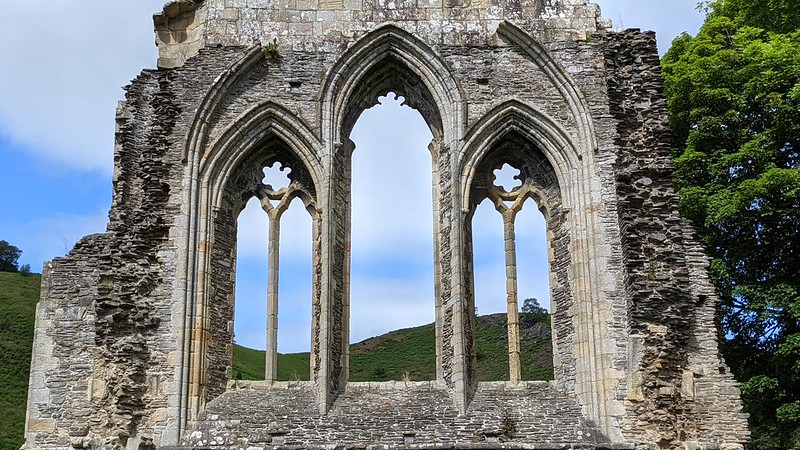
On the way home: Valle Crucis.
Notes
1. Booked via https://www.yourparkingspace.co.uk/ in Tesco's carpark. Alas, Tesco had never heard of them, so I didn't feel able to leave the car. After some subsequent correspondence, they admitted they'd mis-described the place (as being in the nearby leisure center) and refunded my fee.
Kit
For my records. Minimal. ME S'bag (forgot the inner), bivvi, light carrymat, Uberlite, tarp, 2 x skipole; light rucksac; green waterproof coat; fleece; thin long-sleeve; hat; neckwarmer; socks; trailshoes; u'pants x 1. Kindle. Petzl. Gas cyclinder, screw-on stove, pan; misc. Porridge sachets x 10; raisins; 4 x Bounty. 3 x tins of vine leaves. Oatcakes. 1 L water. See-also. Energy pack (used for watch multiple times; down to 2/4 lights after second phone recharge).
No comments:
Post a Comment